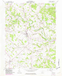
1961 Map of Seaman
USGS Topo · Published 1982About this map
Seaman serves as the primary hub of this Adams County landscape, situated at the junction of the Norfolk and Western railroad and regional roadways. The terrain is defined by the deep incisions of Little West Fork Ohio Brush Creek and Georges Fork West Fork Ohio Brush Creek, which carve through the townships of Winchester, Scott, and Wayne. In the southern reaches, the settlement of Cherry Fork anchors a agricultural region that includes Wheat Ridge and the Wheat Ridge Chapel, illustrating the historical distribution of small rural communities and their local landmarks.
Find a feature on this map
35 named features on this map. Tap any name to fly to it.
Don’t see what you’re looking for? This feature index may not catch every label — zoom into the map to look around manually.
Map Details
Editions of this 1961 Seaman Map
4 editions found
Other maps of this area

1915 · Bainbridge
USGS Topo · 1:48,000

1916 · Peebles
USGS Topo · 1:62,500

1917 · Bainbridge
USGS Topo · 1:62,500

1917 · Hillsboro
USGS Topo · 1:62,500

1918 · Peebles
USGS Topo · 1:62,500

1918 · Seaman
USGS Topo · 1:62,500

1944 · Hillsboro
USGS Topo · 1:62,500

1947 · Columbus
USGS Topo · 1:250,000

1957 · Huntington
USGS Topo · 1:250,000

1960 · Huntington
USGS Topo · 1:250,000