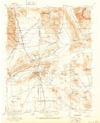
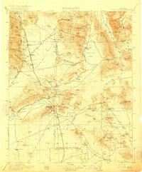
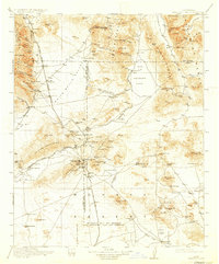
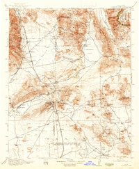
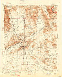
1915 Map of Searles Lake
USGS Topo · Published 1951About this map
Randsburg and Johannesburg serve as the industrial anchors of this high-desert landscape during the early twentieth century, marking a period of intense mineral extraction. The map reveals a complex web of mining operations, including the Arando Mine and Star of the West Mine, supported by the Southern Pacific Railroad and the Trona Railway. The dry expanse of Searles Lake is punctuated by the Soda Works, highlighting the region's importance for chemical production. To the east, the boundary of the Death Valley National Monument marks a transition into the protected desert wilderness. The network of sidings like Mabel Siding and Rademacher Siding illustrates a landscape defined by logistical support for the mines. Small settlements and springs, such as Atolia, Garlock, and Indian Joe Spring, provide critical points of human presence in a terrain characterized by the Argus Range and the El Paso Mountains.
Find a feature on this map
128 named features on this map. Tap any name to fly to it.
Don’t see what you’re looking for? This feature index may not catch every label — zoom into the map to look around manually.
Map Details
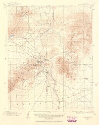
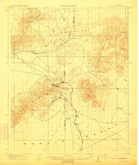
Editions of this 1915 Searles Lake Map
6 editions found

Other maps of this area

1903 · Randsburg
USGS Topo · 1:62,500

1905 · Olancha
USGS Topo · 1:125,000

1906 · Kernville
USGS Topo · 1:125,000

1907 · Olancha
USGS Topo · 1:125,000

1908 · Furnace Creek
USGS Topo · 1:250,000

1908 · Kernville
USGS Topo · 1:125,000

1908 · Ballarat
USGS Topo · 1:250,000

1910 · Furnace Creek
USGS Topo · 1:250,000
1911 · Randsburg
USGS Topo · 1:62,500
1912 · Randsburg
USGS Topo · 1:62,500