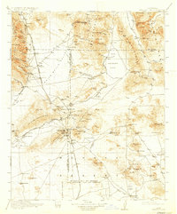
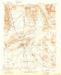
1915 Map of Searles Lake
USGS Topo · Published 1933About this map
Industrial activity and desert mining define this early 20th-century landscape, centered on the vast evaporative crust of Searles Lake. The map details the extraction infrastructure of the era, including the Soda Works and the northern terminus of the Trona RR. To the south, the mining hubs of Johannesburg and Rand anchor a network of claims and settlements like St Elmo and Atolia, connected by the Southern Pacific RR and its Owenyo Branch.
Find a feature on this map
106 named features on this map. Tap any name to fly to it.
Don’t see what you’re looking for? This feature index may not catch every label — zoom into the map to look around manually.
Map Details
Editions of this 1915 Searles Lake Map
6 editions found

Other maps of this area

1903 · Randsburg
USGS Topo · 1:62,500

1905 · Olancha
USGS Topo · 1:125,000

1906 · Kernville
USGS Topo · 1:125,000

1907 · Olancha
USGS Topo · 1:125,000

1908 · Furnace Creek
USGS Topo · 1:250,000

1908 · Kernville
USGS Topo · 1:125,000

1908 · Ballarat
USGS Topo · 1:250,000

1910 · Furnace Creek
USGS Topo · 1:250,000

1911 · Randsburg
USGS Topo · 1:62,500

1912 · Randsburg
USGS Topo · 1:62,500