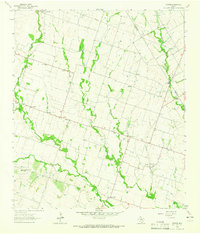
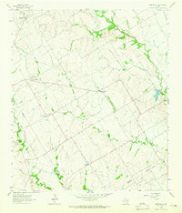
1963 Map of Seaton
USGS Topo · Published 1965About this map
The rolling agricultural land where Bell and Falls counties meet is defined by the branching tributaries of Big Elm Creek, which slice through the prairie in narrow, wooded belts. In the early 1960s, this region remained a network of small farming communities and crossroads settlements such as Seaton, Zabcikville, and Ratibor. The landscape is dotted with evidence of early rural infrastructure, including the Lost Prairie Sch and the National Cem.
Find a feature on this map
29 named features on this map. Tap any name to fly to it.
Don’t see what you’re looking for? This feature index may not catch every label — zoom into the map to look around manually.
Map Details
Editions of this 1963 Seaton Map
Other maps of this area

1885 · Taylor
USGS Topo · 1:125,000

1887 · Taylor
USGS Topo · 1:125,000

1892 · Temple
USGS Topo · 1:125,000

1894 · Taylor
USGS Topo · 1:125,000

1931 · Belton
USGS Topo · 1:62,500

1954 · Waco
USGS Topo · 1:250,000

1954 · Austin
USGS Topo · 1:250,000

1955 · Waco
USGS Topo · 1:250,000
1963 · Yarrelton
USGS Topo · 1:24,000
1963 · Westphalia
USGS Topo · 1:24,000