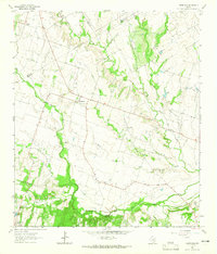
1963 Map of Yarrelton
USGS Topo · Published 1965About this map
The small rural communities of Yarrelton and Marak anchor this agricultural landscape in central Texas during the early 1960s. Located along the junction of several farm-to-market roads, these settlements reflect a mid-century pattern of tight-knit rural life centered around local institutions like the Community Hall and the Cem near North Elm. The terrain is defined by a dendritic network of waterways, including Big Elm Creek and South Elm Creek, which meander through the southern half of the quadrangle toward Buckholts. An interesting navigational detail is the Landing Field located near the northern bend of Big Elm Creek, suggesting a period of increasing local aviation for crop dusting or private travel. Surveyed just before significant modern development, the map also captures the Indefinite Boundary between Bell and Milam counties, along with the precise locations of a Gaging Sta and various rural homesteads connected by a web of light-duty and unimproved dirt roads.
Find a feature on this map
23 named features on this map. Tap any name to fly to it.
Don’t see what you’re looking for? This feature index may not catch every label — zoom into the map to look around manually.
Map Details
Editions of this 1963 Yarrelton Map
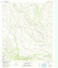
2 editions found
Other maps of this area

1885 · Taylor
USGS Topo · 1:125,000

1887 · Taylor
USGS Topo · 1:125,000

1892 · Temple
USGS Topo · 1:125,000

1894 · Taylor
USGS Topo · 1:125,000

1910 · Buckholts
USGS Topo · 1:24,000

1912 · Buckholts
USGS Topo · 1:31,680

1954 · Waco
USGS Topo · 1:250,000

1954 · Austin
USGS Topo · 1:250,000

1955 · Waco
USGS Topo · 1:250,000

1961 · Cameron
USGS Topo · 1:24,000