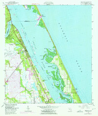
1949 Map of Sebastian
USGS Topo · Published 1975About this map
The Indian River lagoon dominates this coastal landscape, separating the mainland settlements of Sebastian and Roseland from the barrier islands and the Atlantic Ocean. The region's transport identity is defined by the Florida East Coast railway, which parallels the shoreline and connects the small communities of Cummings and Wabasso. Extensive salt marshes and mangrove islands dot the lagoon, including the nationally significant Pelican Island Bird Sanctuary, which stands as a sanctuary for diverse avian populations.
Find a feature on this map
51 named features on this map. Tap any name to fly to it.
Don’t see what you’re looking for? This feature index may not catch every label — zoom into the map to look around manually.
Map Details
Editions of this 1949 Sebastian Map
5 editions found
Other maps of this area

1948 · Riomar
USGS Topo · 1:24,000

1949 · Fellsmere
USGS Topo · 1:24,000

1949 · Sebastian NW
USGS Topo · 1:24,000

1949 · Vero Beach
USGS Topo · 1:24,000

1949 · Sebastian
USGS Topo · 1:24,000

1949 · Grant
USGS Topo · 1:24,000

1950 · Riomar
USGS Topo · 1:24,000

1950 · Vero Beach
USGS Topo · 1:24,000

1951 · Sebastian NW
USGS Topo · 1:24,000

1951 · Fellsmere
USGS Topo · 1:24,000