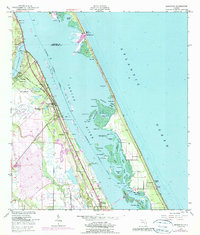
1949 Map of Sebastian
USGS Topo · Published 1990About this map
The Pelican Island Bird Sanctuary occupies a prominent place within the Indian River, surrounded by a complex network of mangrove-laden islands and channels like Turtle Pen Slough and Preachers Hole. Along the mainland shore, the Florida East Coast railway dictates the alignment of early citrus-era settlements such as Roseland, Sebastian, and Wabasso. This 1949 topographic study, updated with 1970 photorevisions, details the transition from a maritime economy toward mid-century development, evidenced by the Sebastian Municipal Airport and the Fish Hatchery near Macedonia Ch. The barrier island remains relatively sparse, punctuated by landmarks like Chobie Dock and the Airway Beacon, while the Intracoastal Waterway cuts a clear path through the lagoon's shallow reaches, including the Sebastian Inlet that connects these protected waters to the Atlantic Ocean.
Find a feature on this map
54 named features on this map. Tap any name to fly to it.
Don’t see what you’re looking for? This feature index may not catch every label — zoom into the map to look around manually.
Map Details
Editions of this 1949 Sebastian Map
5 editions found
Other maps of this area

1948 · Riomar
USGS Topo · 1:24,000

1949 · Fellsmere
USGS Topo · 1:24,000

1949 · Sebastian NW
USGS Topo · 1:24,000

1949 · Vero Beach
USGS Topo · 1:24,000

1949 · Sebastian
USGS Topo · 1:24,000

1949 · Grant
USGS Topo · 1:24,000

1950 · Riomar
USGS Topo · 1:24,000

1950 · Vero Beach
USGS Topo · 1:24,000

1951 · Sebastian NW
USGS Topo · 1:24,000

1951 · Fellsmere
USGS Topo · 1:24,000