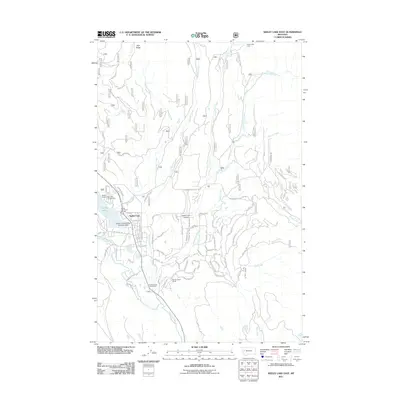
2011 Map of Seeley Lake East
USGS Topo · Published 2011About this map
Seeley Lake serves as the focal point for this mountain landscape, which in 2011 supported a mix of year-round residence, recreational tourism, and forest management. The shoreline is well-developed with facilities such as the Big Larch Campground, Wapiti Resort, and the specialized Lindeys Landing West Seaplane Base. South of the lake, the Double Arrow Ranch and Double Arrow Golf Resort indicate the area's transition toward luxury recreation and seasonal housing, while the residential layout of Seeley Lake town is clearly defined by a dense network of roads like Tamarack Dr and Boyscout Rd.
Find a feature on this map
79 named features on this map. Tap any name to fly to it.
Don’t see what you’re looking for? This feature index may not catch every label — zoom into the map to look around manually.
Map Details
Editions of this 2011 Seeley Lake East Map
This is the sole edition of this map. No revisions or reprints were ever made.
Other maps of this area

1902 · Ovando
USGS Topo · 1:125,000

1905 · Ovando
USGS Topo · 1:125,000

1921 · Elbow Lake
USGS Topo · 1:125,000

1955 · Choteau
USGS Topo · 1:250,000

1957 · Choteau
USGS Topo · 1:250,000

1958 · Choteau
USGS Topo · 1:250,000

1962 · Choteau
USGS Topo · 1:250,000
1965 · Woodworth
USGS Topo · 1:24,000

1965 · Morrell Mountain
USGS Topo · 1:24,000

1965 · Seeley Lake West
USGS Topo · 1:24,000