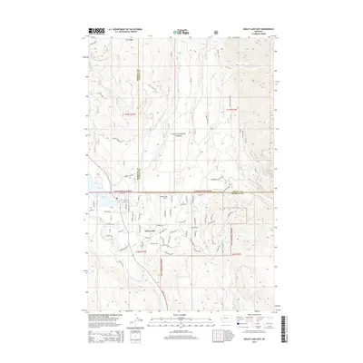
2014 Map of Seeley Lake East
USGS Topo · Published 2014About this map
Seeley Lake and its surrounding mountain drainage systems are the central focus of this 2014 survey on the boundary of Missoula and Powell counties. The settlement of Seeley Lake is bordered by the sprawling Lolo National Forest, with a residential network of roads like Boy Scout Rd and Riverview Dr hugging the eastern shoreline. The landscape is defined by the high elevations of Rice Ridge to the north and a dense network of mountain streams including Morrell Cr and Blind Canyon Cr.
Find a feature on this map
44 named features on this map. Tap any name to fly to it.
Don’t see what you’re looking for? This feature index may not catch every label — zoom into the map to look around manually.
Map Details
Editions of this 2014 Seeley Lake East Map
This is the sole edition of this map. No revisions or reprints were ever made.
Other maps of this area

1902 · Ovando
USGS Topo · 1:125,000

1905 · Ovando
USGS Topo · 1:125,000

1921 · Elbow Lake
USGS Topo · 1:125,000

1955 · Choteau
USGS Topo · 1:250,000

1957 · Choteau
USGS Topo · 1:250,000

1958 · Choteau
USGS Topo · 1:250,000

1962 · Choteau
USGS Topo · 1:250,000
1965 · Woodworth
USGS Topo · 1:24,000

1965 · Morrell Mountain
USGS Topo · 1:24,000

1965 · Seeley Lake West
USGS Topo · 1:24,000