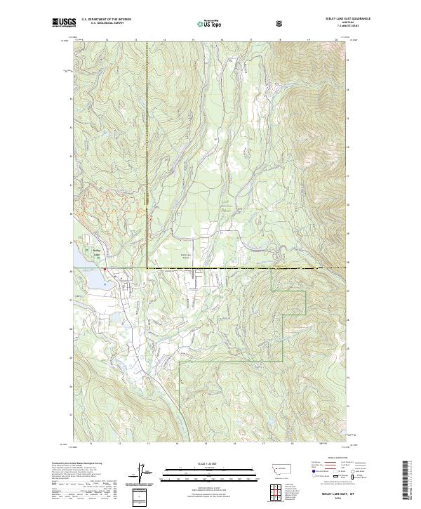
2024 Map of Seeley Lake East
USGS Topo · Published 2024About this map
Seeley Lake sits at the heart of this mountain landscape, serving as a hub for both residential life and forest access. The settlement pattern concentrates near the water, with residential streets like Seeley Ln and Cedar Ln giving way to the sprawling timber and recreation lands of the Lolo National Forest. This modern survey reveals a highly developed network of forest service roads and trails, including the W Morrell-Rice Ridge Loop Trl and Auggie Cutoff Trl, which navigate the steep drainage systems of Morrell Creek and Seeley Creek.
Find a feature on this map
56 named features on this map. Tap any name to fly to it.
Don’t see what you’re looking for? This feature index may not catch every label — zoom into the map to look around manually.
Map Details
Editions of this 2024 Seeley Lake East Map
This is the sole edition of this map. No revisions or reprints were ever made.
Other maps of this area

1902 · Ovando
USGS Topo · 1:125,000

1905 · Ovando
USGS Topo · 1:125,000

1921 · Elbow Lake
USGS Topo · 1:125,000

1955 · Choteau
USGS Topo · 1:250,000

1957 · Choteau
USGS Topo · 1:250,000

1958 · Choteau
USGS Topo · 1:250,000

1962 · Choteau
USGS Topo · 1:250,000
1965 · Woodworth
USGS Topo · 1:24,000

1965 · Morrell Mountain
USGS Topo · 1:24,000

1965 · Seeley Lake West
USGS Topo · 1:24,000