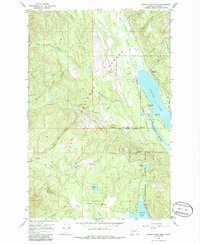
1965 Map of Seeley Lake West
USGS Topo · Published 1986About this map
Seeley Lake Game Preserve and the Clearwater State Forest define this mid-1960s landscape, illustrating a region dedicated to conservation and public recreation. The map showcases the intricate hydrology of the area, where the Clearwater River connects Seeley Lake and Placid Lake, fed by numerous named drainages like Slippery John Creek and Beaver Creek. Human activity is concentrated along the shorelines, marked by facilities such as the Seeley Lake Ranger Station, Camp Paxson, and several organized campgrounds. High-ground points of interest include the Double Arrow Lookout, which overlooks the vast timberlands of the Lolo National Forest. The presence of the Placid Lake Sch near the southern lakeshore provides a specific point of interest for local history researchers and genealogists tracing family ties to this corner of Missoula County.
Find a feature on this map
31 named features on this map. Tap any name to fly to it.
Don’t see what you’re looking for? This feature index may not catch every label — zoom into the map to look around manually.
Map Details
Editions of this 1965 Seeley Lake West Map
2 editions found
Other maps of this area

1902 · Ovando
USGS Topo · 1:125,000

1905 · Ovando
USGS Topo · 1:125,000

1921 · Elbow Lake
USGS Topo · 1:125,000

1955 · Choteau
USGS Topo · 1:250,000

1957 · Choteau
USGS Topo · 1:250,000

1958 · Choteau
USGS Topo · 1:250,000

1962 · Choteau
USGS Topo · 1:250,000

1965 · Upper Jocko Lake
USGS Topo · 1:24,000
1965 · Gold Creek Peak
USGS Topo · 1:24,000

1965 · Seeley Lake West
USGS Topo · 1:24,000