
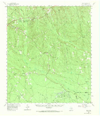
1958 Map of Segno
USGS Topo · Published 1960About this map
The Alabama and Coushatti Indian Reservation anchors the northwestern corner of this East Texas landscape, showing a structured settlement at Indian Village and nearby Camp Ruby. The terrain is defined by a dense network of watercourses, including Big Sandy Creek and Menard Creek, which carve through the timberlands of Polk and Tyler counties. During the late 1950s, the regional economy was driven by the Segno Oil Field and scattered Gravel Pits, alongside the remnants of earlier timber extraction evidenced by an Old Railroad Grade.
Find a feature on this map
39 named features on this map. Tap any name to fly to it.
Don’t see what you’re looking for? This feature index may not catch every label — zoom into the map to look around manually.
Map Details
Editions of this 1958 Segno Map
2 editions found
Other maps of this area

1943 · Liberty
USGS Topo · 1:125,000

1954 · Beaumont
USGS Topo · 1:250,000

1955 · Saratoga
USGS Topo · 1:62,500

1955 · Kountze
USGS Topo · 1:62,500

1955 · Woodville
USGS Topo · 1:62,500

1955 · Camden
USGS Topo · 1:62,500

1955 · Rayburn
USGS Topo · 1:62,500

1955 · New Willard
USGS Topo · 1:62,500

1957 · Beaumont
USGS Topo · 1:250,000

1958 · Livingston
USGS Topo · 1:62,500