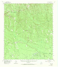
1958 Map of Segno
USGS Topo · Published 1969About this map
The Alabama and Coushatti Indian Reservation occupies the northwest portion of this landscape, centered on the Indian Village and surrounded by a dense network of creek drainages including Big Sandy Creek and Menard Creek. This mid-century survey documents a transitional economy where old timber practices, signaled by an Old Railroad Grade and Johnsons Mill Creek, operate alongside the developing energy sector at the Segno Oil Field. The settlement pattern is defined by small, unincorporated communities like Dallardsville and Holly Grove, each anchored by local landmarks such as Sunflower Ch and Magnolia Hill Ch. Fire suppression and resource management are evident through the placement of the Liberty Hill Lookout, while the southern reaches of the map transition into the swampy terrain of Little Pine Island Bayou at the Polk and Hardin County line.
Find a feature on this map
42 named features on this map. Tap any name to fly to it.
Don’t see what you’re looking for? This feature index may not catch every label — zoom into the map to look around manually.
Map Details
Editions of this 1958 Segno Map
2 editions found

Other maps of this area

1943 · Liberty
USGS Topo · 1:125,000

1954 · Beaumont
USGS Topo · 1:250,000

1955 · Saratoga
USGS Topo · 1:62,500

1955 · Kountze
USGS Topo · 1:62,500

1955 · Woodville
USGS Topo · 1:62,500

1955 · Camden
USGS Topo · 1:62,500

1955 · Rayburn
USGS Topo · 1:62,500

1955 · New Willard
USGS Topo · 1:62,500

1957 · Beaumont
USGS Topo · 1:250,000

1958 · Livingston
USGS Topo · 1:62,500