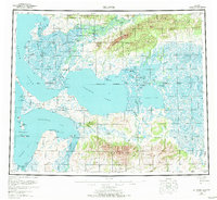
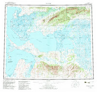
1957 Map of Selawik
USGS Topo · Published 1972About this map
The vast Olikatuk Delta and its intricate network of waterways dominate this mid-century survey of the Northwest Arctic. Settlements like Noorvik and Selawik serve as anchors in a landscape defined by the convergence of the Kobuk River and the Selawik River. This era shows the region as a vital crossroads of indigenous life and early aviation, with the Baldwin Seaplane Anchorage at Elephant Point and a designated Native Reservation spanning the northern reaches.
Find a feature on this map
54 named features on this map. Tap any name to fly to it.
Don’t see what you’re looking for? This feature index may not catch every label — zoom into the map to look around manually.
Map Details
Editions of this 1957 Selawik Map
7 editions found

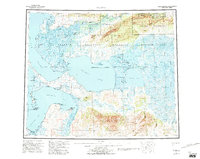
Other maps of this area

1950 · Kotzebue A-1
USGS Topo · 1:63,360

1950 · Bendeleben
USGS Topo · 1:250,000

1950 · Bendeleben D-1
USGS Topo · 1:63,360

1951 · Candle
USGS Topo · 1:250,000

1951 · Baird Mountains
USGS Topo · 1:250,000

1951 · Selawik
USGS Topo · 1:250,000

1951 · Shungnak
USGS Topo · 1:250,000

1951 · Noatak
USGS Topo · 1:250,000

1951 · Bendeleben
USGS Topo · 1:250,000

1951 · Kotzebue
USGS Topo · 1:250,000