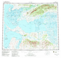
1957 Map of Selawik
USGS Topo · Published 1983About this map
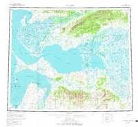
Selawik Lake dominates this Arctic landscape, where the Selawik Delta meets the waters of Hotham Inlet and Kotzebue Sound. This 1957 survey, updated with aerial data through 1980, captures the remote subsistence and transportation networks of the Northwest Arctic. The settlement of Selawik sits at the nexus of Inland Lake and the Selawik River, while the Winter Trail provides a vital overland link across the Kiana Hills to the Kobuk River valley.
Find a feature on this map
49 named features on this map. Tap any name to fly to it.
Don’t see what you’re looking for? This feature index may not catch every label — zoom into the map to look around manually.
Map Details
Editions of this 1957 Selawik Map
7 editions found

Other maps of this area

1950 · Kotzebue A-1
USGS Topo · 1:63,360

1950 · Bendeleben
USGS Topo · 1:250,000

1950 · Bendeleben D-1
USGS Topo · 1:63,360

1951 · Candle
USGS Topo · 1:250,000

1951 · Baird Mountains
USGS Topo · 1:250,000

1951 · Selawik
USGS Topo · 1:250,000

1951 · Shungnak
USGS Topo · 1:250,000

1951 · Noatak
USGS Topo · 1:250,000

1951 · Bendeleben
USGS Topo · 1:250,000

1951 · Kotzebue
USGS Topo · 1:250,000