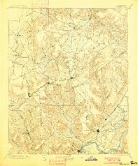
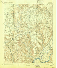
1895 Map of Sewanee
USGS Topo · Published 1900About this map
The Tennessee River snakes through the southern reaches of this survey, defining a landscape of deep coves and elevated plateaus at the end of the nineteenth century. The Nashville Chattanooga and St. Louis RR provides the primary industrial artery, notably passing through the Cowan Tunnel to traverse the Cumberland Plateau. On the heights, Sewanee and Monteagle serve as established mountain communities, while Tracy and South Pittsburg reveal the era's mining and river-based commerce. The map meticulously documents the transition from river bottomlands to the steep escarpments, identifying numerous family-named landmarks like Allison Pt. and Raven Pt.. Large reaches of the plateau are marked by isolated settlements such as Altamont and the resort community of Beersheba Springs, connected by a network of coves including Sweden Cove and Hollingsworth Cove.
Find a feature on this map
115 named features on this map. Tap any name to fly to it.
Don’t see what you’re looking for? This feature index may not catch every label — zoom into the map to look around manually.
Map Details
Editions of this 1895 Sewanee Map
6 editions found

Other maps of this area

1886 · Ringgold
USGS Topo · 1:125,000

1886 · Stevenson
USGS Topo · 1:125,000

1888 · Chattanooga
USGS Topo · 1:125,000

1888 · Scottsboro
USGS Topo · 1:125,000

1892 · Pikeville
USGS Topo · 1:125,000

1892 · Ringgold
USGS Topo · 1:125,000

1892 · Scottsboro
USGS Topo · 1:125,000

1892 · Stevenson
USGS Topo · 1:125,000

1893 · Mc Minnville
USGS Topo · 1:125,000

1893 · Chattanooga
USGS Topo · 1:125,000