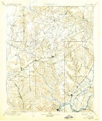
1895 Map of Sewanee
USGS Topo · Published 1930About this map
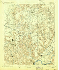
Cumberland Mountain dominates this late-nineteenth-century landscape, where the plateau's complex drainage systems form deep coves and jagged points. The mapping reveals a transitional era for the South Cumberland region, centered on the high-elevation settlements of Sewanee and Monteagle. The transportation network is defined by the Nashville Chattanooga and St. Louis R.R. Main Line, including the critical Cowan Tunnel through the ridge. Along the Elk River and Sequatchie River, the map tracks the industrial and social hubs of the valley, from the iron and coal interests near Victoria and South Pittsburg to the established summer retreat at Beersheba Springs. Notable natural landmarks such as the Natural Bridge and the Stone Door are documented alongside the agricultural pockets of Sweden Cove and Hubbard Cove, illustrating the rugged isolation that once defined these plateau communities.
Find a feature on this map
121 named features on this map. Tap any name to fly to it.
Don’t see what you’re looking for? This feature index may not catch every label — zoom into the map to look around manually.
Map Details
Editions of this 1895 Sewanee Map
6 editions found

Other maps of this area

1886 · Ringgold
USGS Topo · 1:125,000

1886 · Stevenson
USGS Topo · 1:125,000

1888 · Chattanooga
USGS Topo · 1:125,000

1888 · Scottsboro
USGS Topo · 1:125,000

1892 · Pikeville
USGS Topo · 1:125,000

1892 · Ringgold
USGS Topo · 1:125,000

1892 · Scottsboro
USGS Topo · 1:125,000

1892 · Stevenson
USGS Topo · 1:125,000

1893 · Mc Minnville
USGS Topo · 1:125,000

1893 · Chattanooga
USGS Topo · 1:125,000