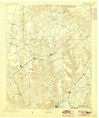
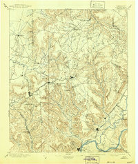
1895 Map of Sewanee
USGS Topo · Published 1905About this map
Cumberland Mountain dominates this late-19th-century landscape, where rugged plateaus and deep coves dictated the path of settlement and industry. The map captures the vital role of the Nashville Chattanooga and St. Louis R. R. as it traverses the terrain, including the engineering feat of the Cowan Tunnel near Sewanee. Numerous coves, such as Hubbard Cove and Sweden Cove, illustrate a pattern of valley-floor agriculture surrounded by steep escarpments. Along the river, South Pittsburg and Jasper stand as key hubs near the Tennessee River, where Rankin Ferry and Loves Ferry provided essential passage before modern bridge networks. The presence of resort towns like Beersheba Springs and Monteagle reflects the era's development of highland retreats atop the plateau, contrasting with the industrial and mining activities centered around Tracy.
Find a feature on this map
114 named features on this map. Tap any name to fly to it.
Don’t see what you’re looking for? This feature index may not catch every label — zoom into the map to look around manually.
Map Details
Editions of this 1895 Sewanee Map
6 editions found

Other maps of this area

1886 · Ringgold
USGS Topo · 1:125,000

1886 · Stevenson
USGS Topo · 1:125,000

1888 · Chattanooga
USGS Topo · 1:125,000

1888 · Scottsboro
USGS Topo · 1:125,000

1892 · Pikeville
USGS Topo · 1:125,000

1892 · Ringgold
USGS Topo · 1:125,000

1892 · Scottsboro
USGS Topo · 1:125,000

1892 · Stevenson
USGS Topo · 1:125,000

1893 · Mc Minnville
USGS Topo · 1:125,000

1893 · Chattanooga
USGS Topo · 1:125,000