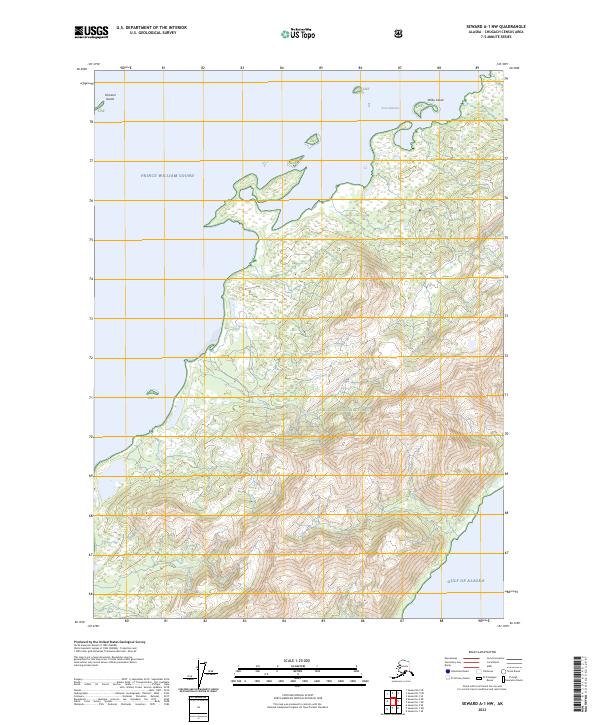
2023 Map of Seward A-1 NW
USGS Topo · Published 2023About this map
Prince William Sound dominates the northern coastal landscape of this Alaskan survey, where the rugged maritime environment meets the protected acreage of the Chugach National Forest. The map documents a sparsely settled wilderness defined by its dramatic transition from the tidal waters of Port Chalmers to the open expanse of the Gulf of Alaska in the southeast. The intricate coastline is dotted with landmarks such as Channel Island and Wilby Island, reflecting the complex geography of the region's fjords and inlets. Topographic detail throughout the Chugach National Forest lands illustrates the steep elevational changes characteristic of the Kenai Peninsula's coastal mountains. This survey provides a baseline for understanding the unchanged character of these coastal reaches, highlighting the isolation of the sound’s shoreline where natural features remain the primary points of orientation.
Find a feature on this map
13 named features on this map. Tap any name to fly to it.
Don’t see what you’re looking for? This feature index may not catch every label — zoom into the map to look around manually.
Map Details
Editions of this 2023 Seward A-1 NW Map
This is the sole edition of this map. No revisions or reprints were ever made.
Other maps of this area

1951 · Seward
USGS Topo · 1:250,000

1951 · Seward B-1
USGS Topo · 1:63,360

1951 · Seward A-2
USGS Topo · 1:63,360

1951 · Seward A-1
USGS Topo · 1:63,360

1951 · Seward B-2
USGS Topo · 1:63,360

1952 · Seward B-1
USGS Topo · 1:63,360

1952 · Seward B-2
USGS Topo · 1:63,360

1953 · Seward A-2
USGS Topo · 1:63,360

1953 · Seward A-1
USGS Topo · 1:63,360

1953 · Seward
USGS Topo · 1:250,000