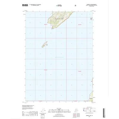
2018 Map of Seward A-2 NE
USGS Topo · Published 2018About this map
Prince William Sound defines the landscape of this remote coastal area, where isolated landmasses emerge from the deep northern waters. Centered within the Chugach National Forest, the map focuses on a cluster of islands that represent the rugged, unpopulated character of the Alaska coastline. The largest feature, Green Island, dominates the northern portion of the sheet with its forested terrain and intricate coastline. To the southwest, the smaller Little Green Island sits alone in the open sound, while Channel Island appears near the eastern boundary. These islands are part of a larger maritime ecosystem where the forest meets the sea, providing a look at the state of these protected lands in the early twenty-first century without any signs of permanent human settlement or modern infrastructure.
Find a feature on this map
13 named features on this map. Tap any name to fly to it.
Don’t see what you’re looking for? This feature index may not catch every label — zoom into the map to look around manually.
Map Details
Editions of this 2018 Seward A-2 NE Map
This is the sole edition of this map. No revisions or reprints were ever made.
Other maps of this area

1951 · Seward
USGS Topo · 1:250,000

1951 · Seward B-1
USGS Topo · 1:63,360

1951 · Seward A-2
USGS Topo · 1:63,360

1951 · Seward A-1
USGS Topo · 1:63,360

1951 · Seward B-2
USGS Topo · 1:63,360

1952 · Seward B-1
USGS Topo · 1:63,360

1952 · Seward B-2
USGS Topo · 1:63,360

1953 · Seward A-2
USGS Topo · 1:63,360

1953 · Seward A-1
USGS Topo · 1:63,360

1953 · Seward
USGS Topo · 1:250,000