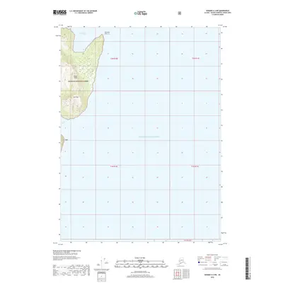
2018 Map of Seward A-2 NW
USGS Topo · Published 2018About this map
Knight Island dominates the western edge of this coastal survey, where the peaks of Horn Mtn rise above the cold waters of Prince William Sound. The shoreline is marked by the sheltered inlet of Snug Harbor to the north and Hogan Bay further south, separated by the prominent coastal landmark of Discovery Point. Much of this land falls within the protected boundaries of the Chugach National Forest, reflecting the undeveloped and maritime character of this remote Alaskan archipelago. The map illustrates a landscape defined by dramatic elevation changes and a complex coastline, providing a clear record of the island's topography and its relationship to the surrounding sounds and passages in the early twenty-first century.
Find a feature on this map
13 named features on this map. Tap any name to fly to it.
Don’t see what you’re looking for? This feature index may not catch every label — zoom into the map to look around manually.
Map Details
Editions of this 2018 Seward A-2 NW Map
This is the sole edition of this map. No revisions or reprints were ever made.
Other maps of this area

1950 · Seward B-3
USGS Topo · 1:63,360

1951 · Seward
USGS Topo · 1:250,000

1951 · Seward A-2
USGS Topo · 1:63,360

1951 · Seward A-3
USGS Topo · 1:63,360

1951 · Seward B-2
USGS Topo · 1:63,360

1952 · Seward A-3
USGS Topo · 1:63,360

1952 · Seward B-3
USGS Topo · 1:63,360

1952 · Seward B-2
USGS Topo · 1:63,360

1953 · Seward A-2
USGS Topo · 1:63,360

1953 · Seward
USGS Topo · 1:250,000