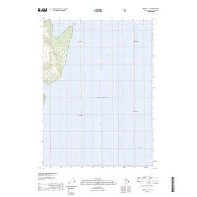
2023 Map of Seward A-2 NW
USGS Topo · Published 2023About this map
Chugach National Forest encompasses the northern reach of Knight Island on this map, documenting a landscape defined by the coastal inlets and mountainous terrain of Prince William Sound. The topography is marked by significant elevations like Horn Mtn, which rises above the protected waters of Snug Harbor and Hogan Bay. This area represents a remote portion of the forest system where maritime access is the primary link to the land. Geographically, Discovery Point serves as a prominent landmark at the island's northern tip. The map provides a clear look at the intricate shoreline and interior landforms of the island as they were surveyed in the early 21st century, offering a baseline for researchers tracking coastal changes or island topography.
Find a feature on this map
12 named features on this map. Tap any name to fly to it.
Don’t see what you’re looking for? This feature index may not catch every label — zoom into the map to look around manually.
Map Details
Editions of this 2023 Seward A-2 NW Map
This is the sole edition of this map. No revisions or reprints were ever made.
Other maps of this area

1950 · Seward B-3
USGS Topo · 1:63,360

1951 · Seward
USGS Topo · 1:250,000

1951 · Seward A-2
USGS Topo · 1:63,360

1951 · Seward A-3
USGS Topo · 1:63,360

1951 · Seward B-2
USGS Topo · 1:63,360

1952 · Seward A-3
USGS Topo · 1:63,360

1952 · Seward B-3
USGS Topo · 1:63,360

1952 · Seward B-2
USGS Topo · 1:63,360

1953 · Seward A-2
USGS Topo · 1:63,360

1953 · Seward
USGS Topo · 1:250,000