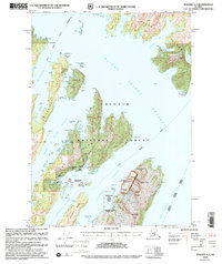
2000 Map of Seward A-3
USGS Topo · Published 2002About this map
Prince William Sound's intricate network of islands and passages is documented in this revision from the turn of the millennium. The map details the industrial and maritime activities around Sawmill Bay, home to Port Ashton and the San Juan Hatchery. The legacy of copper mining is evident on the eastern shore of Latouche Passage, where the Beatson Mine and Blackbird Mine are noted near Larouche.
Find a feature on this map
71 named features on this map. Tap any name to fly to it.
Don’t see what you’re looking for? This feature index may not catch every label — zoom into the map to look around manually.
Map Details
Editions of this 2000 Seward A-3 Map
This is the sole edition of this map. No revisions or reprints were ever made.
Other maps of this area

1946 · Blying Sound
USGS Topo · 1:250,000

1950 · Seward B-3
USGS Topo · 1:63,360

1950 · Blying Sound D-4
USGS Topo · 1:63,360

1951 · Blying Sound
USGS Topo · 1:250,000

1951 · Seward
USGS Topo · 1:250,000

1951 · Seward A-2
USGS Topo · 1:63,360

1951 · Seward B-4
USGS Topo · 1:63,360

1951 · Seward A-3
USGS Topo · 1:63,360

1951 · Blying Sound D-1 and D-2
USGS Topo · 1:63,360

1951 · Seward A-4
USGS Topo · 1:63,360