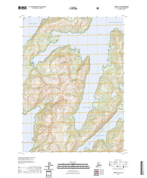
2023 Map of Seward A-4 NE
USGS Topo · Published 2023About this map
Chugach National Forest encompasses this coastal Alaskan landscape where the waters of Prince William Sound meet the Gulf of Alaska. The terrain is defined by dramatic coastal inlets and elevations, including Dual Head and Claw Peak, which rise steeply from the shoreline. Navigational features are prominent, including a designated Ferry Route that traverses the lower portion of the map near Bainbridge Passage. The coastline is heavily indented with sheltered waters such as Whale Bay, Humpback Cove, and Eleshansky Cove. These natural harbors and small drainages like Frenchy Creek reflect the maritime character of the region. While the interior remains largely roadless, the maritime corridors and named coves like Otter Cove suggest the area's importance for transit and seasonal activity within the national forest system.
Find a feature on this map
19 named features on this map. Tap any name to fly to it.
Don’t see what you’re looking for? This feature index may not catch every label — zoom into the map to look around manually.
Map Details
Editions of this 2023 Seward A-4 NE Map
This is the sole edition of this map. No revisions or reprints were ever made.
Other maps of this area

1950 · Seward B-3
USGS Topo · 1:63,360

1951 · Seward
USGS Topo · 1:250,000

1951 · Seward B-4
USGS Topo · 1:63,360

1951 · Seward A-3
USGS Topo · 1:63,360

1951 · Seward A-4
USGS Topo · 1:63,360

1952 · Seward B-4
USGS Topo · 1:63,360

1952 · Seward A-3
USGS Topo · 1:63,360

1952 · Seward B-3
USGS Topo · 1:63,360

1952 · Seward A-4
USGS Topo · 1:63,360

1953 · Seward
USGS Topo · 1:250,000