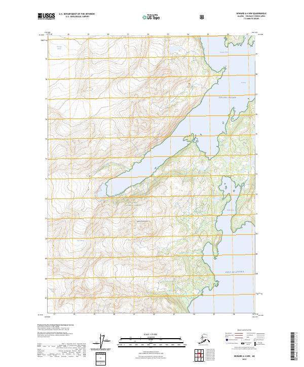
2023 Map of Seward A-4 NW
USGS Topo · Published 2023About this map
The Kenai Peninsula shoreline meets the churning waters of the Gulf of Alaska in this modern topographic survey, revealing a landscape dominated by massive ice fields and deep glacial inlets. Massive rivers of ice, including Chenega Glacier and Bainbridge Glacier, define the western edge of the quadrangle, while Tiger Glacier descends toward the coast. These active ice features carve the rugged coastal terrain within the Chugach National Forest, creating complex maritime features like Nassau Fiord and Icy Bay. The map documents a wilderness where the high-altitude ice of the interior meets the saltwater of the Pacific Ocean, with smaller inlets like Puffin Cove providing sanctuary along the jagged coastline. The survey highlights the intersection of coastal geology and contemporary environmental conditions in one of the most remote sections of the Alaskan coast.
Find a feature on this map
19 named features on this map. Tap any name to fly to it.
Don’t see what you’re looking for? This feature index may not catch every label — zoom into the map to look around manually.
Map Details
Editions of this 2023 Seward A-4 NW Map
This is the sole edition of this map. No revisions or reprints were ever made.
Other maps of this area

1951 · Seward
USGS Topo · 1:250,000

1951 · Seward B-4
USGS Topo · 1:63,360

1951 · Seward A-5
USGS Topo · 1:63,360

1951 · Seward B-5
USGS Topo · 1:63,360

1951 · Seward A-4
USGS Topo · 1:63,360

1952 · Seward A-5
USGS Topo · 1:63,360

1952 · Seward B-4
USGS Topo · 1:63,360

1952 · Seward A-4
USGS Topo · 1:63,360

1952 · Seward B-5
USGS Topo · 1:63,360

1953 · Seward
USGS Topo · 1:250,000