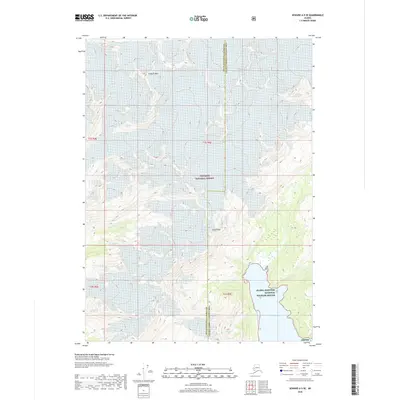
2018 Map of Seward A-5 SE
USGS Topo · Published 2018About this map
Puget Bay cuts into the southern edge of this coastal Alaskan landscape, where the tides of the Gulf of Alaska meet the steep topography of the Kenai Peninsula. Much of the territory is defined by the high elevations of the Chugach Mountains, specifically marked by the prominent heights of Pinnacle Mtn in the north and Puget Peak overlooking the water to the south. This area is characterized by its protected status, falling within the expansive Chugach National Forest and the coastal reaches of the Alaska Maritime National Wildlife Refuge, also noted as Amnwr. The map highlights the intersection of the Kenai Peninsula Borough and the Valdez-Cordova Census Area, illustrating a wilderness interface where mountain peaks provide the primary landmarks in an otherwise roadless terrain.
Find a feature on this map
11 named features on this map. Tap any name to fly to it.
Don’t see what you’re looking for? This feature index may not catch every label — zoom into the map to look around manually.
Map Details
Editions of this 2018 Seward A-5 SE Map
This is the sole edition of this map. No revisions or reprints were ever made.
Other maps of this area

1946 · Blying Sound
USGS Topo · 1:250,000

1950 · Blying Sound D-4
USGS Topo · 1:63,360

1950 · Blying Sound D-5
USGS Topo · 1:63,360

1951 · Blying Sound
USGS Topo · 1:250,000

1951 · Seward
USGS Topo · 1:250,000

1951 · Seward A-5
USGS Topo · 1:63,360

1951 · Seward A-4
USGS Topo · 1:63,360

1952 · Seward A-5
USGS Topo · 1:63,360
1952 · Blying Sound D-5
USGS Topo · 1:63,360

1952 · Seward A-4
USGS Topo · 1:63,360