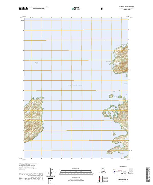
2023 Map of Seward B-1 SW
USGS Topo · Published 2023About this map
Chugach National Forest encompasses the islands and coastal points of this maritime landscape within Prince William Sound. The map reveals a fragmented coastline of major islands like Green Island and smaller landmasses such as Fairs Island, separated by channels like Hayes River Pass. This 2023 edition documents the complex geography of the Sound, where protected waters and rugged points have long shaped navigation and seasonal use. Landforms such as Graveyard Point and Mountain Point mark significant navigation waypoints along the timbered slopes. Further south and east, the sheltered waters of Stockdale Harbor and Port Chalmers provide natural anchorages near Gilmour Point, reflecting the enduring character of these coastal reaches within the national forest system.
Find a feature on this map
15 named features on this map. Tap any name to fly to it.
Don’t see what you’re looking for? This feature index may not catch every label — zoom into the map to look around manually.
Map Details
Editions of this 2023 Seward B-1 SW Map
This is the sole edition of this map. No revisions or reprints were ever made.
Other maps of this area

1951 · Seward
USGS Topo · 1:250,000

1951 · Seward B-1
USGS Topo · 1:63,360

1951 · Seward A-2
USGS Topo · 1:63,360

1951 · Seward A-1
USGS Topo · 1:63,360

1951 · Seward B-2
USGS Topo · 1:63,360

1952 · Seward B-1
USGS Topo · 1:63,360

1952 · Seward B-2
USGS Topo · 1:63,360

1953 · Seward A-2
USGS Topo · 1:63,360

1953 · Seward A-1
USGS Topo · 1:63,360

1953 · Seward
USGS Topo · 1:250,000