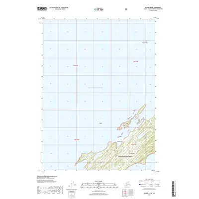
2018 Map of Seward B-2 SE
USGS Topo · Published 2018About this map
Green Island dominates this coastal survey, appearing as a significant landmass within the maritime reaches of Prince William Sound. The island’s topography is defined by its inclusion within the Chugach National Forest, with terrain features such as Putnam Point and Applegate Rock serving as distinctive navigational landmarks in the surrounding waters. This 2018 edition provides a detailed perspective on the shoreline and wilderness boundaries of the area, showing the precise extent of federal forest lands and the intricate coastal edges of the island. The lack of infrastructure or modern development emphasizes the remote character of this part of the sound, where the natural shoreline remains the primary focus of the landscape.
Find a feature on this map
10 named features on this map. Tap any name to fly to it.
Don’t see what you’re looking for? This feature index may not catch every label — zoom into the map to look around manually.
Map Details
Editions of this 2018 Seward B-2 SE Map
This is the sole edition of this map. No revisions or reprints were ever made.
Other maps of this area

1951 · Seward
USGS Topo · 1:250,000

1951 · Seward B-1
USGS Topo · 1:63,360

1951 · Seward A-2
USGS Topo · 1:63,360

1951 · Seward A-1
USGS Topo · 1:63,360

1951 · Seward B-2
USGS Topo · 1:63,360

1952 · Seward B-1
USGS Topo · 1:63,360

1952 · Seward B-2
USGS Topo · 1:63,360

1953 · Seward A-2
USGS Topo · 1:63,360

1953 · Seward A-1
USGS Topo · 1:63,360

1953 · Seward
USGS Topo · 1:250,000