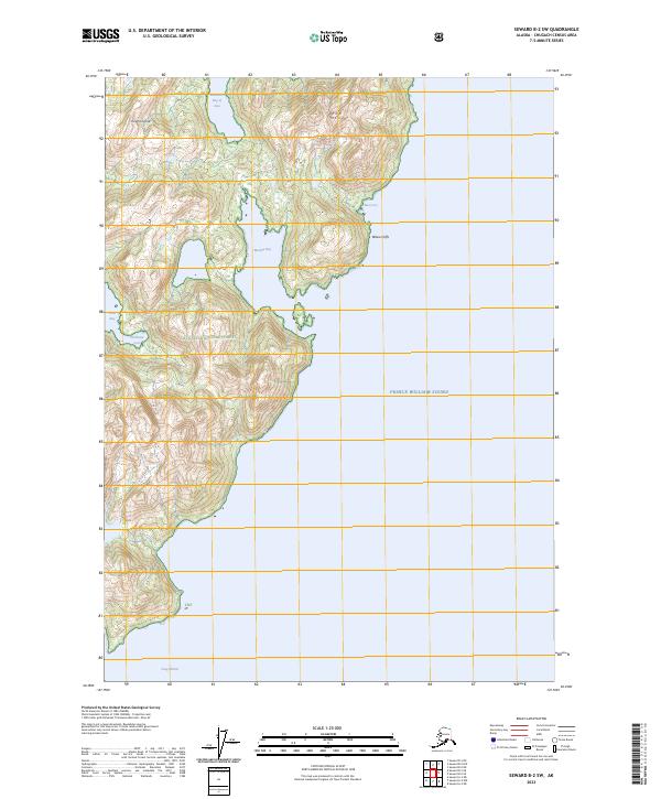
2023 Map of Seward B-2 SW
USGS Topo · Published 2023About this map
Knight Island forms the center of this coastal survey, showcasing the intricate shoreline of Prince William Sound. The terrain is characterized by steep elevation changes, rising quickly from the water's edge to the peak of Iron Mtn. Much of the land falls within the Chugach National Forest, where deep indentations like Marsha Bay and Drier Bay create a labyrinth of protected waters. These inlets, including Northeast Cove and the northern South Arm Bay of Isles, served as critical refuges for maritime traffic and early coastal ventures. To the south, Snug Harbor provides a natural anchorage, while Yellow Cliffs and Rua Cove mark the eastern coast. The map illustrates a wilderness landscape where the intersection of high alpine ridges and sheltered marine environments dictates the pattern of human access and potential historic activity.
Find a feature on this map
16 named features on this map. Tap any name to fly to it.
Don’t see what you’re looking for? This feature index may not catch every label — zoom into the map to look around manually.
Map Details
Editions of this 2023 Seward B-2 SW Map
This is the sole edition of this map. No revisions or reprints were ever made.
Other maps of this area

1950 · Seward B-3
USGS Topo · 1:63,360

1951 · Seward
USGS Topo · 1:250,000

1951 · Seward A-2
USGS Topo · 1:63,360

1951 · Seward A-3
USGS Topo · 1:63,360

1951 · Seward B-2
USGS Topo · 1:63,360

1952 · Seward A-3
USGS Topo · 1:63,360

1952 · Seward B-3
USGS Topo · 1:63,360

1952 · Seward B-2
USGS Topo · 1:63,360

1953 · Seward A-2
USGS Topo · 1:63,360

1953 · Seward
USGS Topo · 1:250,000