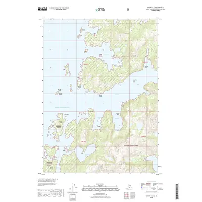
2018 Map of Seward B-3 SE
USGS Topo · Published 2018About this map
Knight Island dominates the eastern reach of this coastal landscape, where the waters of Prince William Sound carve a complex system of deep-water inlets and protected coves. Within the boundaries of the Chugach National Forest, the map reveals a maritime environment shaped by glacial activity and tectonic forces, evidenced by the sheer drop-offs at Mountain Point and the narrow passage of Long Channel. Small archipelagos like the New Year Islands and Clam Islands dot the western waters, providing vital navigational markers for the region's historic coastal trade.
Find a feature on this map
33 named features on this map. Tap any name to fly to it.
Don’t see what you’re looking for? This feature index may not catch every label — zoom into the map to look around manually.
Map Details
Editions of this 2018 Seward B-3 SE Map
This is the sole edition of this map. No revisions or reprints were ever made.
Other maps of this area

1950 · Seward B-3
USGS Topo · 1:63,360

1951 · Seward
USGS Topo · 1:250,000

1951 · Seward A-2
USGS Topo · 1:63,360

1951 · Seward A-3
USGS Topo · 1:63,360

1951 · Seward B-2
USGS Topo · 1:63,360

1952 · Seward A-3
USGS Topo · 1:63,360

1952 · Seward B-3
USGS Topo · 1:63,360

1952 · Seward B-2
USGS Topo · 1:63,360

1953 · Seward A-2
USGS Topo · 1:63,360

1953 · Seward
USGS Topo · 1:250,000