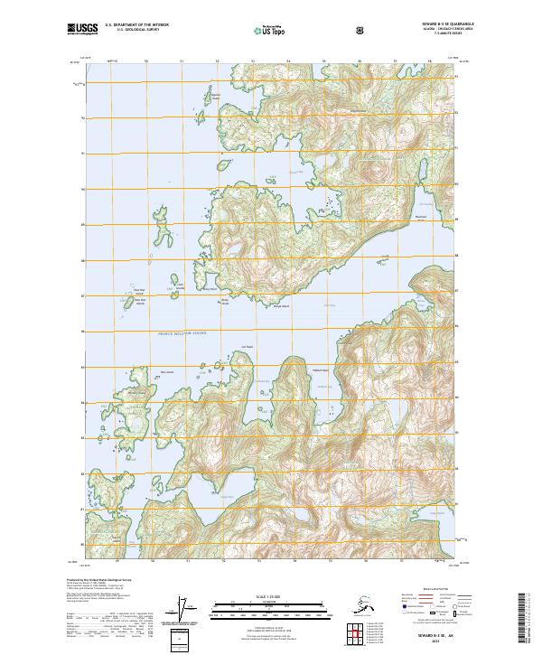
2023 Map of Seward B-3 SE
USGS Topo · Published 2023About this map
Knight Island dominates this portion of Prince William Sound, revealing a complex shoreline defined by deep inlets and narrow channels within the Chugach National Forest. The map documents the intricate geography of the southern island reaches, where significant maritime landmarks like Port Audrey and Snug Harbor provide sheltered points along the eastern coast. The terrain is marked by prominent elevations such as Mountain Point and Cat Head, overlooking a series of smaller landmasses including the New Year Islands, Clam Islands, and Mummy Island. This 2023 survey illustrates the modern contours of the sound's interior waterways, from the broad reaches of Drier Bay and Johnson Bay to the smaller recesses of Mallard Bay and Copper Bay. The naming conventions throughout the quadrangle reflect a long history of maritime navigation and local identification in this corner of the Alaska coast.
Find a feature on this map
32 named features on this map. Tap any name to fly to it.
Don’t see what you’re looking for? This feature index may not catch every label — zoom into the map to look around manually.
Map Details
Editions of this 2023 Seward B-3 SE Map
This is the sole edition of this map. No revisions or reprints were ever made.
Other maps of this area

1950 · Seward B-3
USGS Topo · 1:63,360

1951 · Seward
USGS Topo · 1:250,000

1951 · Seward A-2
USGS Topo · 1:63,360

1951 · Seward A-3
USGS Topo · 1:63,360

1951 · Seward B-2
USGS Topo · 1:63,360

1952 · Seward A-3
USGS Topo · 1:63,360

1952 · Seward B-3
USGS Topo · 1:63,360

1952 · Seward B-2
USGS Topo · 1:63,360

1953 · Seward A-2
USGS Topo · 1:63,360

1953 · Seward
USGS Topo · 1:250,000