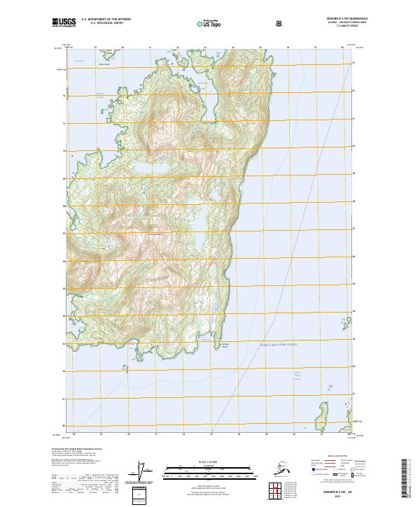
2023 Map of Seward B-3 SW
USGS Topo · Published 2023About this map
Chenega Island dominates this portion of the Chugach National Forest, situated between the waters of Dangerous Passage and Knight Island Passage. The island's shoreline is defined by protected inlets like Chenega Cove, Kake Cove, and Masked Bay, which have historically served as vital harbors for coastal navigation and traditional subsistence activities in Prince William Sound. To the north, Ewan Island and Ewan Point mark the entrance to the deeper waters of Ewan Bay. This map illustrates a landscape of high relief and intricate coastlines where the timbered slopes meet the sea at Chenega Point. The absence of modern infrastructure highlights the primary role of maritime travel in this region, where the names of coves and points remain the principal landmarks for local maritime history.
Find a feature on this map
17 named features on this map. Tap any name to fly to it.
Don’t see what you’re looking for? This feature index may not catch every label — zoom into the map to look around manually.
Map Details
Editions of this 2023 Seward B-3 SW Map
This is the sole edition of this map. No revisions or reprints were ever made.
Other maps of this area

1950 · Seward B-3
USGS Topo · 1:63,360

1951 · Seward
USGS Topo · 1:250,000

1951 · Seward B-4
USGS Topo · 1:63,360

1951 · Seward A-3
USGS Topo · 1:63,360

1951 · Seward A-4
USGS Topo · 1:63,360

1952 · Seward B-4
USGS Topo · 1:63,360

1952 · Seward A-3
USGS Topo · 1:63,360

1952 · Seward B-3
USGS Topo · 1:63,360

1952 · Seward A-4
USGS Topo · 1:63,360

1953 · Seward
USGS Topo · 1:250,000