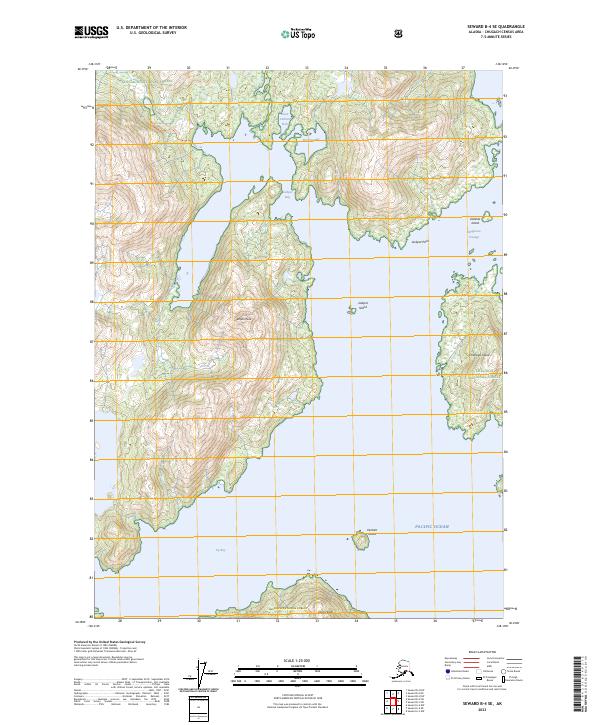
2023 Map of Seward B-4 SE
USGS Topo · Published 2023About this map
Chugach National Forest encompasses this coastal Alaskan landscape, where the waters of the Pacific Ocean meet a complex network of bays and mountainous terrain. The map highlights the significant elevation of Jackpot Peak, which dominates the central landmass between Jackpot Bay and Icy Bay. Navigational features are prominent, including the aptly named Dangerous Passage and the sheltered waters of Seven Fathom Hole and Emerlug Bay. The presence of the Jackpot Bay Easement Trl suggests a point of land-based access within this predominantly maritime environment, while named coastal landmarks like Dual Head and Jackpot Point provide essential reference points for maritime activity. Several islands, such as Chenega Island, Delenia Island, and Verdant Island, further define the intricate shoreline of this wilderness area.
Find a feature on this map
19 named features on this map. Tap any name to fly to it.
Don’t see what you’re looking for? This feature index may not catch every label — zoom into the map to look around manually.
Map Details
Editions of this 2023 Seward B-4 SE Map
This is the sole edition of this map. No revisions or reprints were ever made.
Other maps of this area

1950 · Seward B-3
USGS Topo · 1:63,360

1951 · Seward
USGS Topo · 1:250,000

1951 · Seward B-4
USGS Topo · 1:63,360

1951 · Seward A-3
USGS Topo · 1:63,360

1951 · Seward A-4
USGS Topo · 1:63,360

1952 · Seward B-4
USGS Topo · 1:63,360

1952 · Seward A-3
USGS Topo · 1:63,360

1952 · Seward B-3
USGS Topo · 1:63,360

1952 · Seward A-4
USGS Topo · 1:63,360

1953 · Seward
USGS Topo · 1:250,000