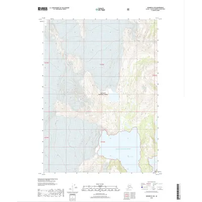
2018 Map of Seward B-4 SW
USGS Topo · Published 2018About this map
Princeton Glacier dominates the northern reaches of this coastal landscape within the Chugach National Forest. The interaction between the ice and the sea is documented along the jagged southern coastline, where the massive Prince William Sound reaches inland through Nassau Fiord. This topographic survey illustrates the steep elevation changes and the specific drainage patterns of the Kenai Peninsula region, showing how the glacier feeds into the surrounding waters. To the southeast, the small indentation of Gaamaak Cove provides a protected point of interest along the shoreline. The map serves as a record of the shoreline and ice extents during the late 2010s, capturing the specific geography of these tidal waters and protected federal lands.
Find a feature on this map
10 named features on this map. Tap any name to fly to it.
Don’t see what you’re looking for? This feature index may not catch every label — zoom into the map to look around manually.
Map Details
Editions of this 2018 Seward B-4 SW Map
This is the sole edition of this map. No revisions or reprints were ever made.
Other maps of this area

1951 · Seward
USGS Topo · 1:250,000

1951 · Seward B-4
USGS Topo · 1:63,360

1951 · Seward A-5
USGS Topo · 1:63,360

1951 · Seward B-5
USGS Topo · 1:63,360

1951 · Seward A-4
USGS Topo · 1:63,360

1952 · Seward A-5
USGS Topo · 1:63,360

1952 · Seward B-4
USGS Topo · 1:63,360

1952 · Seward A-4
USGS Topo · 1:63,360

1952 · Seward B-5
USGS Topo · 1:63,360

1953 · Seward
USGS Topo · 1:250,000