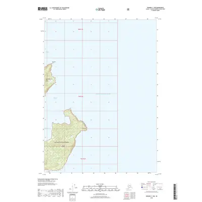
2018 Map of Seward C-1 NW
USGS Topo · Published 2018About this map
Prince William Sound defines this maritime landscape, where the northern reaches of Naked Island and the entirety of Peak Island rise from the deep glacial waters. These landmasses, protected within the Chugach National Forest, exhibit a complex coastline of points and passages shaped by seismic and glacial forces. The map details maritime navigation features such as Liljegren Passage to the northwest and the sheltered McPherson Bay on the western shore of Naked Island. The inclusion of Elk Head Point and East Point provides specific landmarks for maritime history and navigation studies in this part of the Unorganized Borough. This survey illustrates the isolation of these islands, showing no developed roads or permanent settlements, reflecting the wild character of the Chugach region during the early 21st century.
Find a feature on this map
13 named features on this map. Tap any name to fly to it.
Don’t see what you’re looking for? This feature index may not catch every label — zoom into the map to look around manually.
Map Details
Editions of this 2018 Seward C-1 NW Map
This is the sole edition of this map. No revisions or reprints were ever made.
Other maps of this area

1951 · Seward
USGS Topo · 1:250,000

1951 · Seward D-2
USGS Topo · 1:63,360

1951 · Seward D-1
USGS Topo · 1:63,360

1951 · Seward C-1
USGS Topo · 1:63,360

1951 · Seward C-2
USGS Topo · 1:63,360

1952 · Seward C-1
USGS Topo · 1:63,360

1952 · Seward D-1
USGS Topo · 1:63,360

1952 · Seward C-2
USGS Topo · 1:63,360

1952 · Seward D-2
USGS Topo · 1:63,360

1953 · Seward
USGS Topo · 1:250,000