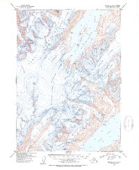
1952 Map of Seward C-5
USGS Topo · Published 1954About this map
The Kenai Mountains dominate this early 1950s survey, defined by an expansive network of ice and deep coastal fjords within the Chugach National Forest. Large glacial systems such as Portage Glacier, Spencer Glacier, and Blackstone Glacier carve through the high elevations, their surfaces marked by numerous crevasses. The map details the complex drainage into Blackstone Bay and Kings Bay, where massive ice flows like the Beloit Glacier and Marquette Glacier meet the sea. Willard Island stands as a prominent landmark in the upper bay, surrounded by sounding depths recorded by the U.S. Coast and Geodetic Survey. This mid-century record captures the specific extent of ice bodies including Whittier Glacier and Taylor Glacier before decades of subsequent change in the Alaskan coastal landscape.
Find a feature on this map
22 named features on this map. Tap any name to fly to it.
Don’t see what you’re looking for? This feature index may not catch every label — zoom into the map to look around manually.
Map Details
Editions of this 1952 Seward C-5 Map
2 editions found

Other maps of this area

1951 · Seward
USGS Topo · 1:250,000

1951 · Seward C-6
USGS Topo · 1:63,360

1951 · Seward D-5
USGS Topo · 1:63,360

1951 · Seward B-4
USGS Topo · 1:63,360

1951 · Seward C-5
USGS Topo · 1:63,360

1951 · Seward D-4
USGS Topo · 1:63,360

1951 · Seward B-6
USGS Topo · 1:63,360

1951 · Seward B-5
USGS Topo · 1:63,360

1951 · Seward C-4
USGS Topo · 1:63,360

1951 · Seward D-6
USGS Topo · 1:63,360