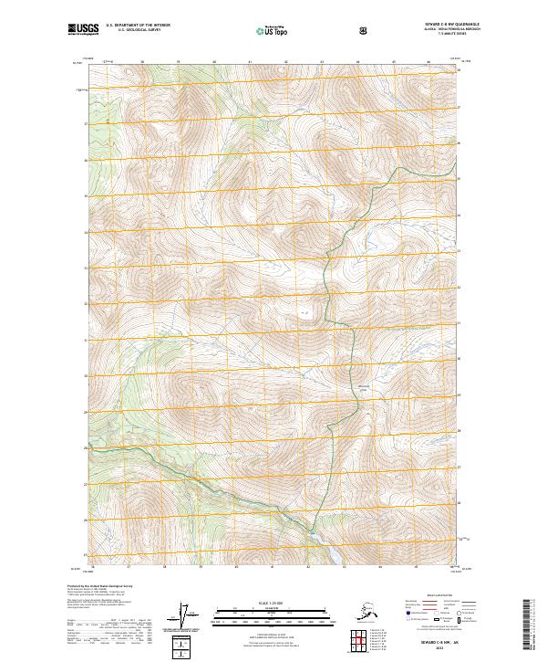
2023 Map of Seward C-8 NW
USGS Topo · Published 2023About this map
Kenai National Wildlife Refuge and the Chugach National Forest meet in this high-elevation wilderness on the Kenai Peninsula. The landscape is defined by its dramatic glacial drainage systems, most notably the south-flowing Chickaloon River and its various tributaries. The central corridor of the map is dominated by American Pass, a significant topographical saddle that separates the drainages of Big Indian Creek to the north from American Creek to the south. This remote territory remains largely untouched by modern infrastructure, preserving the natural hydrological patterns of Abernathy Creek and the surrounding alpine terrain. The map documents the precise administrative boundaries between national forest and wildlife refuge lands, illustrating how these protected areas intersect across the peninsula's mountainous interior.
Find a feature on this map
13 named features on this map. Tap any name to fly to it.
Don’t see what you’re looking for? This feature index may not catch every label — zoom into the map to look around manually.
Map Details
Editions of this 2023 Seward C-8 NW Map
This is the sole edition of this map. No revisions or reprints were ever made.
Other maps of this area

1944 · Kenai
USGS Topo · 1:250,000

1950 · Kenai
USGS Topo · 1:250,000

1951 · Seward
USGS Topo · 1:250,000

1951 · Kenai C-1
USGS Topo · 1:63,360

1951 · Kenai D-1
USGS Topo · 1:63,360

1951 · Seward C-8
USGS Topo · 1:63,360

1951 · Seward D-8
USGS Topo · 1:63,360

1952 · Kenai C-1
USGS Topo · 1:63,360

1952 · Seward D-8
USGS Topo · 1:63,360

1952 · Seward C-8
USGS Topo · 1:63,360