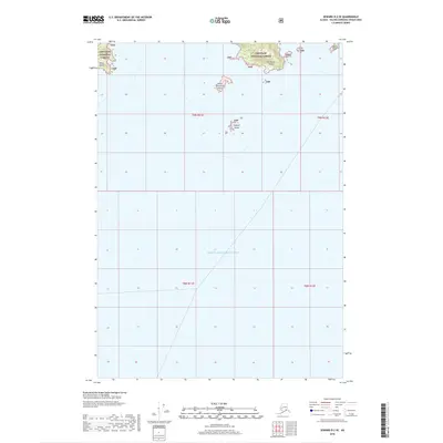
2018 Map of Seward D-2 SE
USGS Topo · Published 2018About this map
Prince William Sound dominates the southern expanse of this coastal Alaskan landscape, where the waters surround a series of isolated landmasses protected within the Chugach National Forest. The map documents a cluster of islands that define the local maritime geography, including the relatively larger Olsen Island and Fairmount Island. To their south and west lie smaller outposts like Little Fairmount Island and the aptly named Outpost Island, which serve as navigational markers for those traversing these northern waters. At the northeastern edge, Granite Point offers a fixed coastal reference. This survey effectively captures the sparse, undeveloped character of the Alaskan shoreline, where land and water meet in a complex network of inlets and sounds, devoid of major infrastructure or settlements.
Find a feature on this map
12 named features on this map. Tap any name to fly to it.
Don’t see what you’re looking for? This feature index may not catch every label — zoom into the map to look around manually.
Map Details
Editions of this 2018 Seward D-2 SE Map
This is the sole edition of this map. No revisions or reprints were ever made.
Other maps of this area

1951 · Seward
USGS Topo · 1:250,000

1951 · Seward D-2
USGS Topo · 1:63,360

1951 · Seward D-1
USGS Topo · 1:63,360

1951 · Seward C-1
USGS Topo · 1:63,360

1951 · Seward C-2
USGS Topo · 1:63,360

1952 · Seward C-1
USGS Topo · 1:63,360

1952 · Seward D-1
USGS Topo · 1:63,360

1952 · Seward C-2
USGS Topo · 1:63,360

1952 · Seward D-2
USGS Topo · 1:63,360

1953 · Seward
USGS Topo · 1:250,000