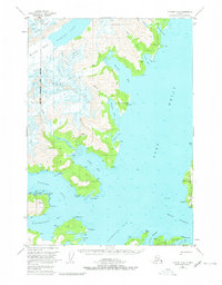
1951 Map of Seward D-4
USGS Topo · Published 1980About this map
Harriman Fiord and the surrounding glacial reaches define this section of the Chugach National Forest during the mid-twentieth century. The landscape is dominated by massive ice flows, including the Roaring Glacier, Dirty Glacier, and Bettles Glacier, which feed into the deep coastal inlets of Port Wells. Human presence is sparse but industrially significant, marked by the Granite Mine near Hobo Bay and the Lansing Mine north of Pigot Bay.
Find a feature on this map
59 named features on this map. Tap any name to fly to it.
Don’t see what you’re looking for? This feature index may not catch every label — zoom into the map to look around manually.
Map Details
Editions of this 1951 Seward D-4 Map
5 editions found
Other maps of this area

1951 · Seward
USGS Topo · 1:250,000

1951 · Anchorage
USGS Topo · 1:250,000

1951 · Seward D-5
USGS Topo · 1:63,360

1951 · Seward C-5
USGS Topo · 1:63,360

1951 · Seward D-4
USGS Topo · 1:63,360

1951 · Seward D-3
USGS Topo · 1:63,360

1951 · Seward C-4
USGS Topo · 1:63,360

1951 · Seward C-3
USGS Topo · 1:63,360

1952 · Seward D-5
USGS Topo · 1:63,360

1952 · Seward D-3
USGS Topo · 1:63,360