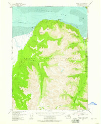
1952 Map of Seward D-8
USGS Topo · Published 1959About this map
Hope sits at the edge of Turnagain Arm in this mid-century survey of the Kenai Peninsula. The settlement marks a transition from the tidal mudflats of Chickaloon Bay to the steep, forested reaches of the Chugach National Forest. Gold mining activity is evident along the drainage of Resurrection Creek, where the Robinson Bowman Mine and Pearson Mine are located alongside visible Tailings. These operations, coupled with the networks of Gold Gulch and Rimrock Creek, illustrate the persistent mineral interest in the region.
Find a feature on this map
41 named features on this map. Tap any name to fly to it.
Don’t see what you’re looking for? This feature index may not catch every label — zoom into the map to look around manually.
Map Details
Editions of this 1952 Seward D-8 Map
3 editions found

Other maps of this area

1944 · Kenai
USGS Topo · 1:250,000

1949 · Tyonek
USGS Topo · 1:250,000

1950 · Kenai
USGS Topo · 1:250,000

1951 · Seward
USGS Topo · 1:250,000

1951 · Anchorage
USGS Topo · 1:250,000

1951 · Tyonek
USGS Topo · 1:250,000

1951 · Kenai C-1
USGS Topo · 1:63,360

1951 · Kenai D-1
USGS Topo · 1:63,360

1951 · Seward C-8
USGS Topo · 1:63,360

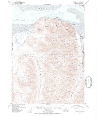
1951 · Seward D-8
USGS Topo · 1:63,360