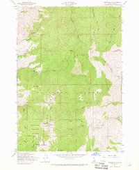
1957 Map of Shafer Butte
USGS Topo · Published 1969About this map
Shafer Butte stands as the central landmark of this high-elevation Boise landscape, which was being developed for regional communication and recreation during the mid-20th century. The peaks are dotted with modern infrastructure, including the VABM Lookout 7582, KBOI TV Towers, and Kido Tv, marking the area as a critical hub for Idaho broadcasting. Lower slopes within the Boise National Forest are defined by the winding Bogus Basin Road and the early layout of Bogus Basin State Park, where several ski tows are already in operation.
Find a feature on this map
37 named features on this map. Tap any name to fly to it.
Don’t see what you’re looking for? This feature index may not catch every label — zoom into the map to look around manually.
Map Details
Editions of this 1957 Shafer Butte Map
4 editions found
Other maps of this area

1892 · Boise
USGS Topo · 1:125,000

1894 · Idaho Basin
USGS Topo · 1:125,000

1897 · Boise
USGS Topo · 1:125,000

1949 · Robie Creek
USGS Topo · 1:24,000

1954 · Boise North
USGS Topo · 1:24,000

1954 · Boise
USGS Topo · 1:62,500

1955 · Hailey
USGS Topo · 1:250,000

1955 · Boise
USGS Topo · 1:250,000

1957 · Cartwright Canyon
USGS Topo · 1:24,000

1957 · Horseshoe Bend
USGS Topo · 1:24,000