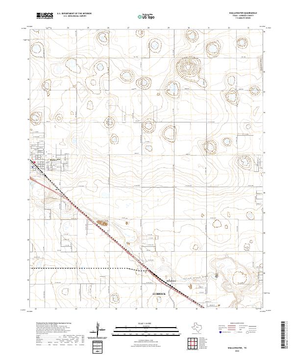
2022 Map of Shallowater
USGS Topo · Published 2022About this map
Shallowater and the outlying neighborhoods north of Lubbock define this segment of the Llano Estacado. The landscape is characterized by its organized grid of agricultural and residential corridors, such as Quaker Ave and Milwaukee Ave, which cut across the high plains. Two significant drainage features, Yellow House Draw and Blackwater Draw, interrupt the plateau, reflecting the ancient watercourses that shaped this region's topography long before modern irrigation and settlement.
Find a feature on this map
88 named features on this map. Tap any name to fly to it.
Don’t see what you’re looking for? This feature index may not catch every label — zoom into the map to look around manually.
Map Details
Editions of this 2022 Shallowater Map
This is the sole edition of this map. No revisions or reprints were ever made.
Other maps of this area

1954 · Lubbock
USGS Topo · 1:250,000

1954 · Brownfield
USGS Topo · 1:250,000

1956 · Shallowater
USGS Topo · 1:24,000

1956 · New Deal
USGS Topo · 1:24,000

1957 · Lubbock East
USGS Topo · 1:24,000

1957 · Lubbock West
USGS Topo · 1:24,000

1957 · Lubbock
USGS Topo · 1:62,500

1957 · Anton
USGS Topo · 1:62,500

1957 · Abernathy
USGS Topo · 1:62,500

1957 · Wolfforth
USGS Topo · 1:62,500