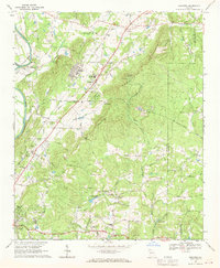
1968 Map of Shannon
USGS Topo · Published 1970About this map
Shannon and the Northwest Georgia Experimental Station anchor the landscape of this 1968 survey of Floyd County. The area is defined by the winding course of the Oostanaula River and the steep elevation of Armuchee Ridge. The industrial and agricultural character of the era is evident through infrastructure like the Filtration Plant and Sewage Disposal near Shannon, as well as the Southern Railway corridor which parallels the main road network.
Find a feature on this map
86 named features on this map. Tap any name to fly to it.
Don’t see what you’re looking for? This feature index may not catch every label — zoom into the map to look around manually.
Map Details
Editions of this 1968 Shannon Map
4 editions found
Other maps of this area

1886 · Rome
USGS Topo · 1:125,000

1890 · Cartersville
USGS Topo · 1:125,000

1891 · Cartersville
USGS Topo · 1:125,000

1896 · Cartersville
USGS Topo · 1:125,000

1898 · Rome
USGS Topo · 1:125,000

1899 · Rome
USGS Topo · 1:125,000

1904 · Rome
USGS Topo · 1:125,000

1906 · Stilesboro
USGS Topo · 1:62,500

1908 · Stilesboro
USGS Topo · 1:62,500

1941 · Adairsville
USGS Topo · 1:62,500