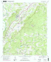
1968 Map of Shannon
USGS Topo · Published 1986About this map
Shannon serves as a prominent industrial and residential hub in this late 1960s survey, defined by its position along the Southern Railway and proximity to the Northwest Georgia Experimental Station. The landscape transitions from the agricultural flats near the Oostanaula River to the prominent heights of Armstrong Mountain. Notable civic and rural landmarks are scattered throughout the Floyd County countryside, including Model High Sch and the Hermitage Lookout Tower. Educational and religious life is well-documented through numerous country churches like Rush Chapel and Big Pleasant Grove Ch. The presence of a Landing Strip, Filtration Plant, and a Gravel Pit near the railway suggests an era of local infrastructure development, while family names on features like Halls Lake and Howell Lake provide valuable touchstones for regional genealogy and land-use history.
Find a feature on this map
79 named features on this map. Tap any name to fly to it.
Don’t see what you’re looking for? This feature index may not catch every label — zoom into the map to look around manually.
Map Details
Editions of this 1968 Shannon Map
4 editions found
Other maps of this area

1886 · Rome
USGS Topo · 1:125,000

1890 · Cartersville
USGS Topo · 1:125,000

1891 · Cartersville
USGS Topo · 1:125,000

1896 · Cartersville
USGS Topo · 1:125,000

1898 · Rome
USGS Topo · 1:125,000

1899 · Rome
USGS Topo · 1:125,000

1904 · Rome
USGS Topo · 1:125,000

1906 · Stilesboro
USGS Topo · 1:62,500

1908 · Stilesboro
USGS Topo · 1:62,500

1941 · Adairsville
USGS Topo · 1:62,500