1949 Map of Sharpes
USGS Topo · Published 1981About this map
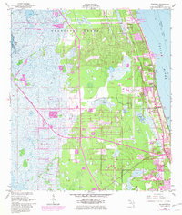
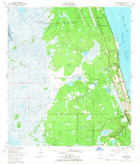
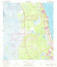
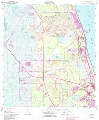
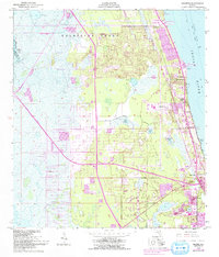
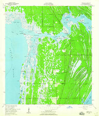
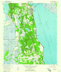
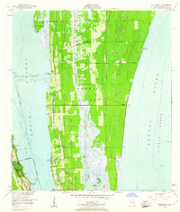
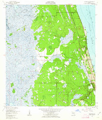
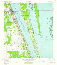
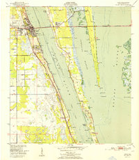
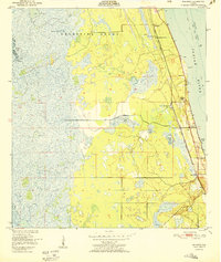
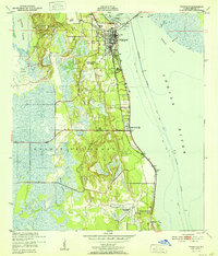
The Delespine Grant anchors this coastal landscape along the Indian River, illustrating the mid-century transition of Florida's Atlantic shoreline. While the original 1949 topography shows a series of established rail-oriented communities like Frontenac, Sharpes, and City Point, later revisions highlight the encroaching urbanization of the space age. The expansion of Cocoa and the construction of the Bee Line Toll Road Expressway signal the infrastructure shifts that accompanied regional growth near the coast. Along the western edge, the marshy interior is dotted with water bodies such as Halfway Lake and Lake Wilson, contrasting with the industrial and residential developments to the east. Local history researchers can trace the path of the Florida East Coast railroad and identify early landmarks like the Powerplant at Delespine and the distinctive Williams Point.
Find a feature on this map
25 named features on this map. Tap any name to fly to it.
Don’t see what you’re looking for? This feature index may not catch every label — zoom into the map to look around manually.
Map Details
Editions of this 1949 Sharpes Map
6 editions found
Other maps of this area
1949 · Orsino
USGS Topo · 1:24,000
1949 · Titusville
USGS Topo · 1:24,000
1949 · Courtenay
USGS Topo · 1:24,000
1949 · Sharpes
USGS Topo · 1:24,000
1949 · Cocoa
USGS Topo · 1:24,000
1951 · Cocoa
USGS Topo · 1:24,000

1951 · Courtenay
USGS Topo · 1:24,000
1951 · Sharpes
USGS Topo · 1:24,000

1951 · Orsino
USGS Topo · 1:24,000
1952 · Titusville
USGS Topo · 1:24,000