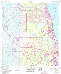
1949 Map of Sharpes
USGS Topo · Published 1988About this map
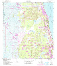
The Indian River shoreline defines this mid-century portrait of coastal Brevard County, where the transition from mid-19th-century land grants to modern transportation networks is clearly visible. The large Delespine Grant occupies much of the northern landscape, providing a window into the region's earlier Spanish land grant history. Along the river, the Florida East Coast railway serves a string of riverside communities including Frontenac, Sharpes, and City Point.
Find a feature on this map
24 named features on this map. Tap any name to fly to it.
Don’t see what you’re looking for? This feature index may not catch every label — zoom into the map to look around manually.
Map Details
Editions of this 1949 Sharpes Map
6 editions found
Other maps of this area

1949 · Orsino
USGS Topo · 1:24,000

1949 · Titusville
USGS Topo · 1:24,000

1949 · Courtenay
USGS Topo · 1:24,000

1949 · Sharpes
USGS Topo · 1:24,000

1949 · Cocoa
USGS Topo · 1:24,000

1951 · Cocoa
USGS Topo · 1:24,000

1951 · Courtenay
USGS Topo · 1:24,000

1951 · Sharpes
USGS Topo · 1:24,000

1951 · Orsino
USGS Topo · 1:24,000

1952 · Titusville
USGS Topo · 1:24,000