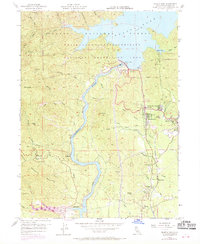
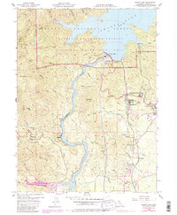
1956 Map of Shasta Dam
USGS Topo · Published 1970About this map
Shasta Dam stands as the engineering centerpiece of this mid-century landscape, regulating the Sacramento River and creating the expansive Shasta Lake. The area's industrial character is defined by a dense concentration of mineral extraction sites such as the Uncle Sam Mine and Balakala Mine, while the Southern Pacific railroad snakes along the river canyon, providing essential transit for the region's timber and ore.
Find a feature on this map
53 named features on this map. Tap any name to fly to it.
Don’t see what you’re looking for? This feature index may not catch every label — zoom into the map to look around manually.
Map Details
Editions of this 1956 Shasta Dam Map
5 editions found
Other maps of this area

1890 · Red Bluff
USGS Topo · 1:250,000

1894 · Red Bluff
USGS Topo · 1:250,000

1901 · Redding
USGS Topo · 1:125,000

1913 · Weaverville
USGS Topo · 1:125,000

1944 · Redding
USGS Topo · 1:62,500

1944 · French Gulch
USGS Topo · 1:62,500

1946 · Lamoine
USGS Topo · 1:62,500

1946 · Redding
USGS Topo · 1:62,500

1948 · French Gulch
USGS Topo · 1:62,500

1950 · Schell Mtn
USGS Topo · 1:62,500