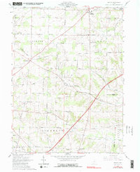
1961 Map of Shauck
USGS Topo · Published 1990About this map
The Chestnut Ridge defines the northern topography of this 1961 survey, where the settlements of Johnsville and Shauck anchor the local road network. The landscape is a patchwork of early townships, including Congress, Perry, and Franklin, divided by the historic line where Congress Lands meet the United States Military District. This boundary is physically traced by Treaty Line Road, providing a clear geographic marker of early Ohio land divisions.
Find a feature on this map
55 named features on this map. Tap any name to fly to it.
Don’t see what you’re looking for? This feature index may not catch every label — zoom into the map to look around manually.
Map Details
Editions of this 1961 Shauck Map
4 editions found
Other maps of this area

1913 · Mount Gilead
USGS Topo · 1:62,500

1915 · Shauck
USGS Topo · 1:62,500

1915 · Marengo
USGS Topo · 1:62,500

1915 · Fredericktown
USGS Topo · 1:62,500

1916 · Mount Gilead
USGS Topo · 1:62,500

1943 · Shauck
USGS Topo · 1:62,500

1943 · Marengo
USGS Topo · 1:62,500

1943 · Mount Gilead
USGS Topo · 1:62,500

1943 · Fredericktown
USGS Topo · 1:62,500

1950 · Marion
USGS Topo · 1:250,000
Featured Places
- Perry Township, OH
- Congress Township, OH
- Franklin Township, OH
- Middlebury Township, OH
- Perry Township, OH