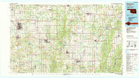
1985 Map of Shawnee
USGS Topo · Published 1990About this map
Shawnee and Tecumseh anchor the western edge of this 1980s landscape, a region defined by the winding paths of the North Canadian River and the Canadian River. This period shows a mature network of central Oklahoma communities, including the county seats of Wewoka and Holdenville. The map captures the specialized cultural and educational landscape of the time, noting St Gregory College in Shawnee and the settlement of Sacred Heart to the south.
Find a feature on this map
91 named features on this map. Tap any name to fly to it.
Don’t see what you’re looking for? This feature index may not catch every label — zoom into the map to look around manually.
Map Details
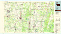
Editions of this 1985 Shawnee Map
2 editions found
Other maps of this area

1896 · Seminole and Prague
USGS Topo · 1:125,000

1896 · Okmulgee
USGS Topo · 1:125,000

1896 · Coalgate
USGS Topo · 1:125,000

1898 · Purcell
USGS Topo · 1:125,000

1898 · McAlester
USGS Topo · 1:125,000

1898 · Pauls Valley
USGS Topo · 1:125,000

1899 · Coalgate
USGS Topo · 1:125,000

1900 · Canadian
USGS Topo · 1:125,000

1900 · Wewoka
USGS Topo · 1:125,000

1900 · Okmulgee
USGS Topo · 1:125,000