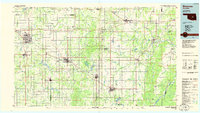
1985 Map of Shawnee
USGS Topo · Published 1985About this map
The North Canadian River and the Canadian River snake across this central Oklahoma landscape, framing a region defined by its rail history and petroleum-era growth. Major regional hubs like Shawnee and Holdenville are shown alongside smaller vanished-interest locales such as Econtuchka and Garden Grove. The map captures the dense network of the Atchison Topeka and Santa Fe Railway and the St Louis-San Francisco Railway before the widespread abandonment of mid-century branch lines. Educational and social landmarks, including St Gregory College near Shawnee, provide fixed points for local historians. The transition from prairie to more wooded terrain is evident as one moves east toward the Deep Fork, while man-made water features like Sportsman Lake and Lake Wewoka illustrate the late 20th-century development of the region's water infrastructure.
Find a feature on this map
94 named features on this map. Tap any name to fly to it.
Don’t see what you’re looking for? This feature index may not catch every label — zoom into the map to look around manually.
Map Details
Editions of this 1985 Shawnee Map
2 editions found
Other maps of this area

1896 · Seminole and Prague
USGS Topo · 1:125,000

1896 · Okmulgee
USGS Topo · 1:125,000

1896 · Coalgate
USGS Topo · 1:125,000

1898 · Purcell
USGS Topo · 1:125,000

1898 · McAlester
USGS Topo · 1:125,000

1898 · Pauls Valley
USGS Topo · 1:125,000

1899 · Coalgate
USGS Topo · 1:125,000

1900 · Canadian
USGS Topo · 1:125,000

1900 · Wewoka
USGS Topo · 1:125,000

1900 · Okmulgee
USGS Topo · 1:125,000